Ghana is divided into 16 administrative regions. Each region has its capital city and several districts. One of those regions is the Ashanti Region. The Ashanti Region is the largest administrative area in Ghana, and it is located in the southern parts of the country. It has an area of 24,389 square kilometres, which is about 10.2% of Ghana’s total land area. Unlike other administrative zones in Ghana, many districts in the Ashanti Region are among the most populated in Ghana.

Based on a 2011 census, the total number of people in all the districts in the Ashanti Region is 4.7 million. That makes up about 19.4% of Ghana’s population. Historically, districts in this area are known for being principal producers of cocoa and gold bar.
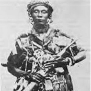
The people that live in this territory are known as the Ashanti or Asante. They are part of the Akan ethnic group and are a matrilineal society that traces their line of descent through the female. Some of the economic activities of the area include the production of manganese, bauxite, and agricultural commodities, pottery, clothing, textiles and finance.
What is the capital of the Ashanti Region?
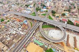
Kumasi is the capital of the Ashanti Region and one of the largest metropolitan areas of Ghana. It is one of the key historical centres of the country, located in the rain forest region. You will find Kumasi about 500 kilometres north of the Equator and 200 kilometres north of the Gulf of Guinea.
List of Districts in the Ashanti Region of Ghana
How many districts are in the Ashanti Region? Well, the Region has 30 districts. They consist of 1 metropolitan area, seven municipals, and 22 ordinary districts. Since its political administration is through a local government system, each district, municipal, or metropolitan, is headed by a Chief Executive. Here are the districts in the Ashanti Region and their capitals:
1. Kumasi Metropolitan District – Kumasi
Kumasi Metropolitan District is the most populated zone in the Ashanti Region. Its administrative capital is Kumasi, a commercial, industrial, and cultural capital of the region. Other popular areas in Kumasi include Buokrom and Adum. Some of its primary economic activities are professional services and manufacturing.
2. Asokore Mampong Municipal – Asokore Mampong
Asokore Mampong Municipal District forms part of the 43 Metropolitan, and District Assemblies in Ghana. Before it became a municipality, it came out of the Kumasi Metropolitan Assembly in 2012. That makes it one of the new districts in the Ashanti region of Ghana.
3. Adansi North – Fomena
The Adansi North District is part of the Ashanti Region of Ghana established in 2004. Before its establishment, it was part of the Adansi West, East, South, and Obuasi Municipal districts. The administrative capital of the area is Fomena.
4. Atwima Kwanwoma – Foase Kokoben
Atwima Kwanwoma District is one of the new districts in the Ashanti Region established in 2008. Its administrative capital is Foase Kokoben located in the central portion of the Ashanti region. The territory has two Area Councils and 21 electoral Areas.
5. Amansie Central – Jacobu
Amansie Central District came to being in 2003 after splitting from Amansie East District. Its administrative capital is Jacobu, an area rich in resources, including gold and timber. The district also plays a significant role in exporting most of the Ghanaian foodstuffs, since a majority of the people are farmers.
6. Kwabre East – Mamponteng
Kwabre East is a district that was historically part of the Kwabre Sekyere District until 1988. In 2007, it became Kwabre East District after the formation of the Afigya Kwabre District, which was part of the Kwabre District. Its capital, Mamponteng, is approximately 14.5 kilometres from Kumasi.
7. Sekyere East – Effiduase
Sekyere East District came to being in 1988, with Effiduase as its capital. The area covers an estimated land of about 239.1 square kilometres. It also has about 42 settlements of varying sizes, with farming, retail trade, and small-scale agro-processing being the primary economic activities.
8. Bosomtwe – Kuntenase
Bosomtwe District was once part of the Bosomtwe-Atwima-Kwanwoma District. It covers an area of 500 square kilometres, which is about 1% of the land of the Ashanti Region. The territory has many minerals, including gold, clay, and sand.
9. Sekyere South – Agona Ashanti
Sekyere South District is in the north-eastern part of the Ashanti Region, with Agona Ashanti being the administrative capital. The district’s habitat is tropical forest, with a majority of its inhabitants being farmers. Cassava, plantains, yams, and maize are the most grown food crops in the area.
10. Offinso Municipal – Offinso
Offinso Municipal is a district in the northwestern part of the Ashanti Region, with Offinso being its capital. The municipality has a paramount chief known as the Offinsohene and several sub-chiefs. Every two years, the inhabitants celebrate the Mmoaninko Afahye, a festival that brings together people to discuss the area’s development.
11. Ahafo Ano South – Mankranso
Ahafo Ano South is a district in the Ashanti Region established in 1988. It came out of the old Ahafo Ano District, which meant its administrative capital had to change to Mankranso. The territory has an area of 1,241 square kilometres.
12. Adansi South – New Edubiase
Adansi South District is the southernmost district of the Ashanti Region. Its capital, New Edubiase, is an area known for eco-tourism. The territory lies in a forest and boasts of many scenic waterfalls and mountain ranges.
13. Asante Akim North – Agogo
Asante Akim North Municipal District covers an area of 1,160 square kilometres. The territory experiences a wet semi equatorial type of climate, with temperatures averaging highs of 260C. Agogo, located approximately 80 kilometres east of Kumasi, is the administrative capital of the district.
14. Ejisu-Juaben Municipal – Ejisu
Ejisu-Juaben Municipal District lies in the central part of the Ashanti Region, with an area of 637.2 square kilometres. Ejisu is the district’s strategic location. It is the political and administrative capital.
15. Amansie West – Manso Nkwanta
Amansie West District serves as a regional boundary between the Ashanti Region on one side and Central and Western Region on the other side. It covers an area of 1,364 square kilometres, with four ethnic groups occupying the territory. Manso Nkwanta is the district capital, and it is about 65 kilometres from Kumasi.
16. Asante Akim South – Juaso
Asante Akim South District serves as the entry and exit point to the Ashanti Region. It has 16 operational zones that work to facilitate the provision of extension services to the farmers of the area. Its administrative and political capital is Juaso.
17. Ejura/Sekyedumase – Ejura
Ejura/Sekyedumase is a district located in the northern part of the Ashanti Region. With an area of 1,782.2 square kilometres, it is the largest maize producing district in the Ashanti Region of Ghana. The town of Ejura serves as the district capital.
18. Ahafo Ano North – Tepa
Ahafo Ano North District is a rainforest region characterised by high and continuous rainfall. Tepa, which is the area’s capital, has many inhabitants whose occupation is farming. The territory is one of the most crucial cocoa-growing regions of Ghana.
19. Asante Akim Central Municipal – Konongo
Asante Akim Central Municipal lies in the eastern part of the Ashanti Region. Konongo is its administrative capital, which is a gold bar and manganese mining community. The district came to being in 1988 after carving out of the erstwhile Asante Akim District Council.
20. Sekyere Kumawu – Kumawu
Sekyere Kumawu is one of the 260 Metropolitan, Municipal, and District Assemblies in Ghana. With Kumawu as its administrative and political capital, it covers an area of 3,500.56 square kilometres. The district’s endowments include tomato, cassava, maize, and cocoa farming.
21. Sekyere Afram Plains – Drobonso
Sekyere Afram Plains is one of the new districts established and inaugurated in 2012. Its capital is Drobonso and lies in the north-eastern part of the Ashanti Region. The zone has one constituency and ten electoral areas.
22. Afigya-Kwabre – Kodie
Afigya-Kwabre District has a total area of 342.3 square kilometres, which forms about 1.44% of the total land area of the Ashanti Region. Kodie is the district capital of Afigya-Kwabre. It houses the area’s assembly.
23. Atwima Mponua – Nyinahin
Atwima Mponua is the westernmost district in the Ashanti Region. The territory and its capital, Nyinahin, came to being in 2003 after it was part of Atwima District. Mining and agriculture are the primary economic activities of the area.
24. Atwima Nwabiagya – Nkawie
Atwima Nwabiagya District and its capital Nkawire was part of the Atwima District until its formation in 2003. It lies within the wet semi-equatorial zone marked by double maximum rainfall. Agriculture, manufacturing, services, and commerce are the area’s economic activities.
25. Bekwai Municipal – Bekwai
Bekwai Municipal Assembly was part of the Amansie East District until its formation in 2008. The municipality has 27 electoral areas and 11 government appointees, with Bekwai as its administrative capital. Its location is in the southern part of the Ashanti Region.
26. Bosome Freho – Asiwa
Bosome Freho District is among the new districts and municipalities created in 2008. Its administrative headquarters is Asiwa, a name derived from the cocoa seedling. The territory is in the southeastern part of the Ashanti Region, a rural forest ecological zone of Ghana.
27. Mampong Municipal – Mampong
Mampong Municipal District lies in the north-east of Kumasi. The municipality, whose administrative capital is Mampong, has a land area of 782 square kilometres. Most of its inhabitants are farmers and grow maize, cassava, plantains, cocoyam, and yam as their food crops.
28. Obuasi Municipal – Obuasi
Obuasi Municipal District was part of the Adansi West District Assembly until its formation in 2003. The municipality is at the southern part of the Ashanti Region. Its administrative capital is Obuasi, a place known for having one of the largest gold mines in the world.
29. Offinso North – Akomadan
Offinso North became a district in 2008. Its administrative headquarters are in Akomadan, a place that produces more tomatoes compared to many locations in Ghana. The territory covers an area of about 6,300 square kilometres.
30. Sekyere Central – Nsuta
Sekyere Central District is among the newly created municipalities and districts of the Ashanti Region. Its capital is Nsuta, which also hosts the area’s markets where farmers sell their agricultural produce. Agriculture is the primary economic activity of the district.
The Ashanti Region of Ghana has a population of 4.7 million people based on the 2011 census. Some of the districts in the Ashanti Region include Kumasi Metropolitan District, Asokore Mampong Municipal, Adansi North, and Atwima Kwanwoma, among others. Production of manganese, bauxite, and agricultural commodities, pottery, clothing, textiles and finance are some of the leading economic activities in the area.